


Voting Districts not defined, Dukes County, Massachusetts
About
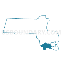
Outline

Summary
| Unique Area Identifier | 593888 |
| Name | Voting Districts not defined |
| County | Dukes County |
| State | Massachusetts |
| Area (square miles) | 382.62 |
| Land Area (square miles) | 0.04 |
| Water Area (square miles) | 382.58 |
| % of Land Area | 0.01 |
| % of Water Area | 99.99 |
| Latitude of the Internal Point | 41.32117950 |
| Longtitude of the Internal Point | -70.80090330 |
Maps


Graphs
Select a template below for downloading or customizing gragh for Voting Districts not defined, Dukes County, Massachusetts


Neighbors
Neighoring Voting District (by Name) Neighboring Voting District on the Map
- Aquinnah Precinct 1, Dukes County, MA
- Chilmark Precinct 1, Dukes County, MA
- Edgartown Precinct 1, Dukes County, MA
- Gosnold Precinct 1, Dukes County, MA
- Oak Bluffs Precinct 1, Dukes County, MA
- Tisbury Precinct 1, Dukes County, MA
- Voting Districts not defined, Barnstable County, MA
- Voting Districts not defined, Bristol County, MA
- Voting Districts not defined, Nantucket County, MA
- West Tisbury Precinct 1, Dukes County, MA
Top 10 Neighboring County Subdivision (by Population) Neighboring County Subdivision on the Map
- Dartmouth town, Bristol County, MA (34,032)
- Falmouth town, Barnstable County, MA (31,531)
- Oak Bluffs town, Dukes County, MA (4,527)
- Edgartown town, Dukes County, MA (4,067)
- Tisbury town, Dukes County, MA (3,949)
- West Tisbury town, Dukes County, MA (2,740)
- Chilmark town, Dukes County, MA (866)
- Aquinnah town, Dukes County, MA (311)
- Gosnold town, Dukes County, MA (75)
- County subdivisions not defined, Barnstable County, MA (0)
Top 10 Neighboring Place (by Population) Neighboring Place on the Map
Top 10 Neighboring Elementary School District (by Population) Neighboring Elementary School District on the Map
- Oak Bluffs School District, MA (4,527)
- Edgartown School District, MA (4,067)
- Tisbury School District, MA (3,949)
- Up-Island Regional School District, MA (3,917)
Top 10 Neighboring Secondary School District (by Population) Neighboring Secondary School District on the Map
Top 10 Neighboring Unified School District (by Population) Neighboring Unified School District on the Map
- Dartmouth School District, MA (34,032)
- Falmouth School District, MA (31,531)
- Gosnold School District, MA (75)
- School District Not Defined (Water), MA (0)
Top 10 Neighboring State Legislative District Lower Chamber (by Population) Neighboring State Legislative District Lower Chamber on the Map
Top 10 Neighboring State Legislative District Upper Chamber (by Population) Neighboring State Legislative District Upper Chamber on the Map
Top 10 Neighboring 111th Congressional District (by Population) Neighboring 111th Congressional District on the Map
Top 10 Neighboring Census Tract (by Population) Neighboring Census Tract on the Map
- Census Tract 2002, Dukes County, MA (4,527)
- Census Tract 2003, Dukes County, MA (4,067)
- Census Tract 2004, Dukes County, MA (3,992)
- Census Tract 2001, Dukes County, MA (3,949)
- Census Tract 9900, Barnstable County, MA (0)
- Census Tract 9900, Bristol County, MA (0)
- Census Tract 9900, Dukes County, MA (0)
- Census Tract 9900, Nantucket County, MA (0)
Top 10 Neighboring 5-Digit ZIP Code Tabulation Area (by Population) Neighboring 5-Digit ZIP Code Tabulation Area on the Map
- 02557, MA (4,491)
- 02539, MA (4,067)
- 02568, MA (4,000)
- 02575, MA (2,725)
- 02535, MA (1,177)
- 02543, MA (635)
- 02713, MA (52)